River Dee (Afon Dyfrdwy)
Dan Jones is the River Dee (English Section) access officer for the British Canoe Union. Happy to give advice by email or phone if what is detailed below is not suffice.
Whilst High On Adventure Ltd makes every effort that the information contained below is accurate we will not be held negligent for any claims arising from kayaking on the River Dee. In providing this information we stress that words and risk assessments alone don’t keep people safe – well informed decisions based on relevant experience, appropriate skills and sound knowledge do. Ask yourself are you competent to embark on the journey planned, look after yourself and others if something goes wrong. It is hoped that this page goes someway into providing an up-to-date source of useful information and guidance.
The access situation on the English Section of the River Dee is excellent, long may it continue. All users appreciate and respect the rights of others to be there. Please help to foster this relationship between all parties and strengthen whenever possible.
The River Dee was designated as a Site of Special Scientific Interest (SSSI) in 1996. The reasoning behind this designation is provided on the English Nature Website, from which a very useful document detailing the rich biodiversity can be downloaded, link below.
http://www.english-nature.org.uk/citation/citation_photo/2000452.pdf
The following maybe of interest:
Countryside Code including information on open access
The Rivers Access Campaign. A campaign funded by the BCU raising awareness of the access issue on inland waterways in England and Wales and also campaigning to bring about change.
www.riversaccess.org/pages/pv.asp?p=rac2
The British Canoe Union . You, your canoe and the environment webpages and downloadable leaflet.
www.canoe-england.org.uk/canoeeng/
2305-3-you%2c-your-canoe-and-the-environment.aspx
www.canoe-england.org.uk/canoeeng/CoachingItemPDFs/upload_1319.pdf
Details
Country: United Kingdom ( England and Wales )
Length: 110km (68 miles)
Watershed: 1800km² (695mi²)
Average Rainfall: 640mm
Discharge: Chester Weir – 37m³/s
Source: Slopes of Dduallt above Llanuwchllyn (Snowdonia)
Mouth: Dee Estuary
The River Dee has been providing drinking water to the local area since the 1600s, originally for the City of Chester , now 2 million people from North East Wales and the North West of England now receive their essential water supplies from the river. Dee Valley Water extract 73 million litres as untreated water every day, 83% from the River Dee, 10% from the upland reservoirs ( Bala Lake , Llyn Brenig and Llyn Celyn) and the remaining 7% from underground sources.
Access
Access / Egress Point |
Description |
Grid Reference (SJ) |
Distance from nearest access / egress point upstream |
Holt Road Bridge |
Car Park |
(411,544) |
|
|
River Alun joins from West |
(398, 560) |
2.85km |
|
Pulford Brook joins from West |
(409,577) |
7.27km (Leg 4.42km) |
|
Iron Bridge |
(417,601) |
10.95km (Leg 3.68km) |
Eccleston Ferry |
Car Park |
(415,621) |
14.25km (Leg 3.3km) |
Sandy Lane |
Car Park |
(419,660) |
4.27km |
Chester Weir |
Car Park |
(407,658) |
1.68km |
|
|
|
|
Distances
Journey |
Distance |
Time Taken (3km/hr, 5km/hr, 7km/hr) |
||
Holt to Eccleston |
14.25km |
4hr 45mins |
2hr 51mins |
2hr 4 mins |
Holt to Sandy Lane |
18.52km |
6hr 10mins |
3hr 42mins |
2hr 39mins |
Holt to Chester Weir |
20.2km |
6hr 44mins |
4hr 2mins |
2hrs 53mins |
Eccleston to Sandy Lane |
4.27km |
1hr 25mins |
51mins |
37mins |
Eccleston to Chester Weir |
5.95km |
1hr 59mins |
1hr 11mins |
51 mins |
Sandy Lane to Chester Weir |
1.68km |
34mins |
20mins |
14mins |
Access points are described above ( Holt Road Bridge , upstream river right; Eccleston Ferry, Sandy Lane and Chester Weir Area)
About
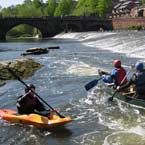
Chester Weir provides a useful moving water play-spot. The salmon steps provide a route down, in all but the very lowest of water levels, each step providing a useful playspot. The final and last step is the largest, it is possible (for some!) to continually cartwheel in this last hole, though a very small boat is needed to avoid hitting the bottom in low water levels (and a playboating ability beyond mine!).
A water stream at the bottom of the steps provides a useful current in which to introduce basic moving water skills, with 2 eddies on either side and a further very small current between the 2 small islands.
In very high flows then a stopper forms along the length of the weir which can hold a boat and kayaker, until the two part company. Objects being washed over the weir are of particular concern at such times, the salmon steps tend to wash out in very high flows. A speedy rescue is required at these times to avoid being washed under the old Dee bridge, from which heading back upstream between the bridges to the egress point can be tricky.
The River Dee is tidal to way beyond Eccleston, though it needs to be Spring tides to pass over the weir. As the water levels drop and the tide changes direction a small green wave forms which is excellent to surf along, moments later it forms a small stopper, fun again to play. High Water at Chester is approximately 1hour after High Water at Liverpool .
The Dee Bore is “surfable” from Queensferry – good luck. Only done it once at midnight a long time ago. I believe tides above 10.5m at Liverpool are required.
Access can be from Sandy Lane or there is parking for a small number of cars above the weir on the town centre side of the river, near the bandstand.
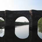
Egress – on river left opposite small island just before Old Dee Bridge , series of wooden steps. Carry then along left bank to above the Old Mill where a landing jetty can be seen on the left hand side.
At low flows the weir can be walked up carrying boats and a return made from there to the bandstand car park or back upstream to Sandy Lane .
Facilities: Ice Cream stands along the river on all but the coldest of days.
Toilets near the bandstand on river right, just after paddling under the Suspension Bridge from upstream.
Handbridge next to Chester Weir and on the opposite side of the river to the town centre provides a usual mix of small local shops – 1 minute walk from first egress point.
A number of signs have appeared that are a suggested reference point in case of emergency, these are labelled with either R (right bank) or L (left bank) and then a number. They should be referred to in case of an incident which requires outside assistance so that your location can be identified.
Environment Agency Incident hotline: 0800 807060 (Freephone* 24 Hour)
(To report an environmental incident)
RSPCA – Telephone 0990 55 59 99 (24 hours) Report birds or animals in distress.
British Canoe Union – Link to Policy (includes participation statement, safety and emergency procedures)
www.bcu.org.uk/bcu/250-3-policy.aspx
On line rivers guidebook providing information and pictures for rivers throughout the UK , with a specific link for the English Section of the River Dee provided below.
www.ukriversguidebook.co.uk/deefarndon.htm
An account of the history of the area and useful information about the river.
en.wikipedia.org/wiki/River_Dee,_Wales
Customer Feedback
»


![View our e-flyer? [.PDF] View our e-flyer? [.PDF]](images/pdf_flyer.gif)
